Drive from the historic limestone storefronts of downtown Galt up toward the post-war suburban grid of Hespeler, and you feel the topography shift under your tires. Cambridge, Ontario, sits on the western edge of the Paris-Galt moraine, where thick glacial till and silty sand deposits drape over deeply incised river valleys. The Grand and Speed Rivers have carved steep, sometimes unstable slopes that behave very differently than the flat farmland just outside town. In Galt, we often see near-vertical cuts in stiff clay till that stand for decades until a wet spring saturates the upper layer and triggers a shallow slide. Over in Hespeler, the slopes are gentler but the sand seams within the till create perched water tables that catch contractors off guard. A proper slope stability analysis here means reading the landscape first and the spreadsheet second. Our field team has walked these banks in every season, and we learned early that Cambridge geology doesn't fit a single textbook profile. Before opening a cut on a Mill Creek tributary, it makes sense to pair the slope assessment with a CPT test to map those thin sand lenses that control pore pressure.
A Cambridge slope that looks stable in August can be one heavy rain away from movement if the till-sand interface isn't mapped.
Scope of work in Cambridge Ontario
Critical ground factors in Cambridge Ontario
The mistake we see repeated in Cambridge is treating a slope stability analysis as a desktop exercise with assumed parameters pulled from a generic textbook table. A contractor will take a SPT N-value from a single borehole at the crest, convert it to a friction angle using a correlation meant for clean sand, run a Bishop simplified analysis, and call it done. Then the excavation starts, the cut exposes a slickensided clay seam at the till-bedrock contact, and the whole bench starts creeping toward the river. We have been called to more than one Preston site where the shoring had to be redesigned mid-project because the original geotechnical report missed a groundwater layer perched in a sand lens, or worse, assumed the weathered shale at the base of the slope would behave like intact rock. In Cambridge's moraine terrain, you cannot skip the field reconnaissance and you cannot skip the pore pressure measurement. Piezometers installed during the investigation phase pay for themselves ten times over when they prevent a slope failure during construction. The Grand River Conservation Authority also has specific setback and erosion access requirements that must be built into the analysis from the start.
Our services
Our slope stability work in Cambridge covers everything from preliminary feasibility studies for infill lots to forensic analysis of active landslides. We tailor the investigation scope to the site constraints and the project risk profile.
Limit Equilibrium Analysis
We run both circular (Bishop, Spencer) and non-circular (Morgenstern-Price) failure surface searches using site-specific shear strength parameters from triaxial or direct shear testing. Each analysis includes pore pressure scenarios calibrated to Cambridge's seasonal groundwater fluctuations.
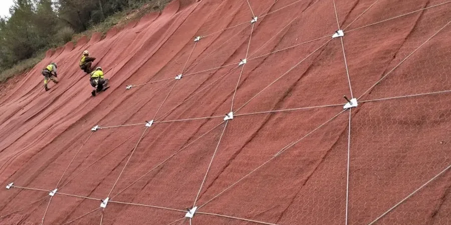
Construction Monitoring and Instrumentation
For slopes within the zone of influence of active construction, we install slope inclinometers, piezometers, and survey markers to track movement in real time. This is especially relevant on the tight lots along the Speed River where vibration from pile driving can trigger displacement in adjacent slopes.
Frequently asked questions
What triggers a slope failure in Cambridge's glacial till?
The most common trigger we see is heavy rainfall or rapid snowmelt that saturates the upper weathered zone of the till. Water infiltrates through cracks and root holes, builds up pore pressure at the interface between the weathered crust and the intact till below, and reduces the effective stress to the point where the factor of safety drops below 1.0. In Cambridge's river valleys, erosion at the toe of the slope by the Grand or Speed River also removes passive support and can initiate a progressive failure.
Do I need a slope stability analysis for a single-family home addition in Preston?
If your lot is within the regulated area of the Grand River Conservation Authority, or if the slope adjacent to the proposed addition is steeper than 1V:3H, then yes, the GRCA and the City of Cambridge building department will likely require a geotechnical assessment. Even outside the regulated area, we recommend an analysis if the addition extends closer than the height of the slope to the crest. The cost of the analysis is far less than the cost of remedial work if movement occurs later.
How much does a slope stability analysis cost in Cambridge Ontario?
For a typical residential or small commercial site in Cambridge, a slope stability analysis including site investigation, laboratory testing, and a stamped report generally falls between CA$1.590 and CA$5.900. The final cost depends on the number of boreholes or test pits required, the type of laboratory testing (direct shear vs. triaxial), and the complexity of the groundwater conditions. We provide a fixed-fee proposal after a site walk.
How long does the analysis take from start to finish?
A straightforward analysis for a single slope profile on an uncomplicated site can be completed in three to four weeks from mobilization of the drilling crew to delivery of the stamped report. If piezometers are installed to monitor seasonal groundwater levels, we typically read them over a minimum of one wet season, which extends the timeline to three or four months. We always discuss the schedule trade-offs during the proposal stage.