The Grand River valley cuts through Cambridge, leaving behind layered deposits of silty clay and glacial till that complicate every deep excavation. Groundwater sits high in the Hespeler area, just 2 to 4 metres below grade during spring melt. We instrument every cut with automated total stations and vibrating wire piezometers to track lateral movement and pore pressure shifts before they become problems. When a contractor opens a foundation in the Galt core, older lacustrine clays can relax fast—monitoring provides the early warning that visual inspection misses. The Ontario Building Code requires documented surveillance for excavations exceeding 6 metres, and our deep excavation designs integrate that data from day one.
Real-time pore pressure data from vibrating wire piezometers has stopped more excavation collapses in Cambridge than any amount of post-failure analysis ever will.
Scope of work in Cambridge Ontario
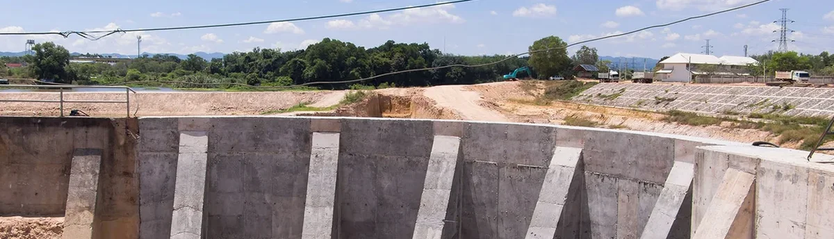
Critical ground factors in Cambridge Ontario
Cambridge sits on a complex interface between the Guelph Formation dolostone and overlying Quaternary sediments. The glacial Lake Whittlesey clays found across the city's west side are particularly sensitive—their undrained shear strength can drop from 50 kPa to under 15 kPa when remoulded by construction vibration. A deep excavation near a creek tributary adds the risk of basal heave if the confining weight is removed too quickly. Without continuous piezometric data, a contractor might pump out groundwater and unknowingly trigger a quick condition in the silty layer below the cut. That scenario has played out in Southern Ontario before. Monitoring provides the quantitative trigger to slow down, reinforce, or revise the dewatering plan before soil fabric is lost.
Our services
Each excavation monitoring program in Cambridge is designed around the specific shoring type, soil profile, and adjacent infrastructure. The instrumentation packages we deploy include:
Inclinometer Monitoring
Vertical inclinometer casings installed behind shoring walls or through landslide-prone slopes, read with a dual-axis probe to detect lateral deformation at 0.5 m intervals.
Vibrating Wire Piezometer Network
Multi-level VWP strings in fully grouted boreholes to track pore pressure dissipation during staged dewatering, with automated data logging and SMS alerting.
Automated Total Station Survey
Robotic total stations tracking prism targets on shoring faces, adjacent buildings, and utility corridors, delivering sub-millimetre trending data updated hourly.
Settlement and Heave Arrays
Deep rod extensometers paired with surface settlement plates to separate shallow compaction from deep heave, critical in Cambridge's layered clay-till profiles.
Frequently asked questions
What excavation depth triggers mandatory monitoring in Cambridge?
The Ontario Building Code requires documented geotechnical monitoring for any excavation deeper than 6 metres. However, we recommend instrumentation for shallower cuts when they are within a 1:1 influence zone of sensitive structures or when groundwater control is active. For excavations in the soft Lake Whittlesey clays found in west Cambridge, monitoring often starts at 4 metres.
How much does a typical excavation monitoring program cost in Cambridge Ontario?
A complete instrumentation package—inclinometers, vibrating wire piezometers, settlement markers, and automated total station monitoring over an 8-week excavation period—ranges from CA$1,200 to CA$3,520 depending on the number of monitoring points, reading frequency, and reporting requirements. Weekly manual-only programs fall at the lower end, while real-time automated systems with cloud dashboard access represent the upper range.
How often are inclinometers read during active excavation?
During active digging and dewatering, we read inclinometers daily. Once excavation reaches final grade and shoring loads stabilize, the frequency drops to twice weekly, then weekly during the foundation construction phase. If lateral movement exceeds 50% of the design allowable at any reading, we immediately notify the site superintendent and the design engineer and increase frequency to twice daily.
What alerts does the automated monitoring system generate?
The system triggers three alert levels: advisory when movement reaches 60% of design allowable, warning at 80%, and critical at 100%. Alerts go via SMS and email to a pre-defined distribution list. The dashboard also flags sensor battery levels, data gaps exceeding one read interval, and any total station line-of-sight obstruction so the field team can respond before data loss occurs.